


Navionics+ Large Charts
£229.00 £219.95
Navionics+ cartography provides integrated offshore and inland marine mapping content with rivers, bays and more than 42,000 lakes around the world. This all-in-one solution offers clear, reliable cartography for the widest range of chartplotter brands.
Please check the Navionics website for full compatibility. Navionics+ is not compatible with Garmin chartplotters. They use either Bluechart G3 or Garmin Navionics+.
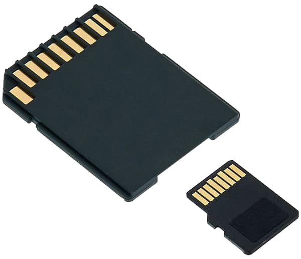
Please note: All charts come as a mirco SD inside an SD card adaptor.
Part Number
Region
Port Solent
Warehouse
99238230
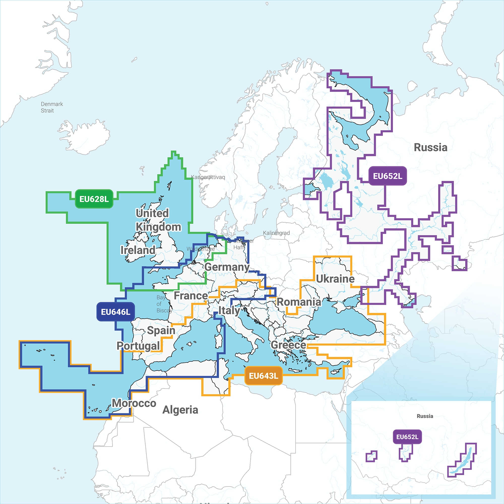
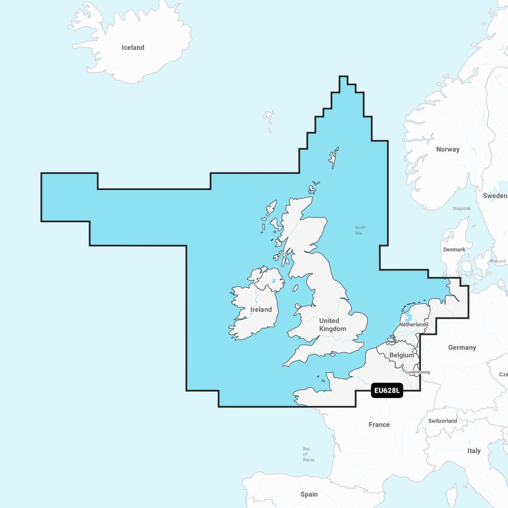
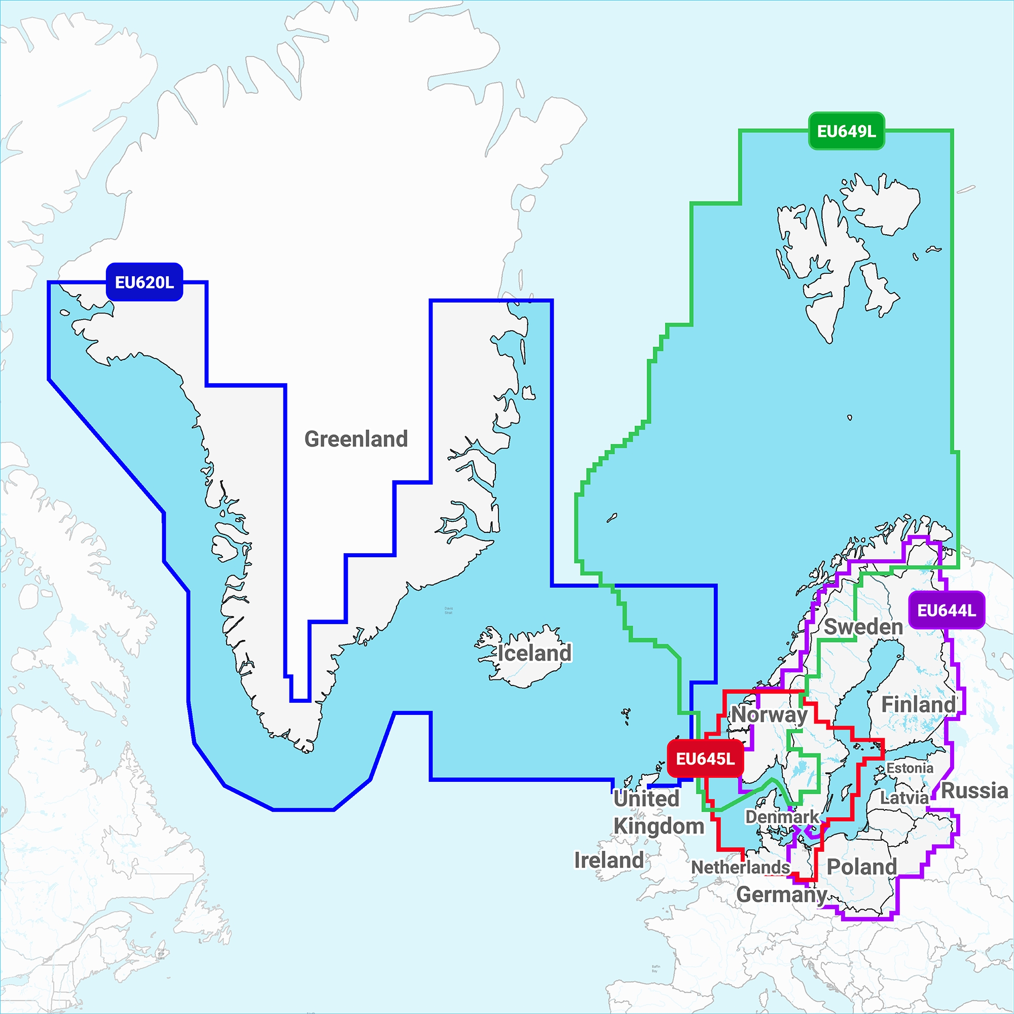
EU628L / 28XG UK & Ireland
2
3
99664015
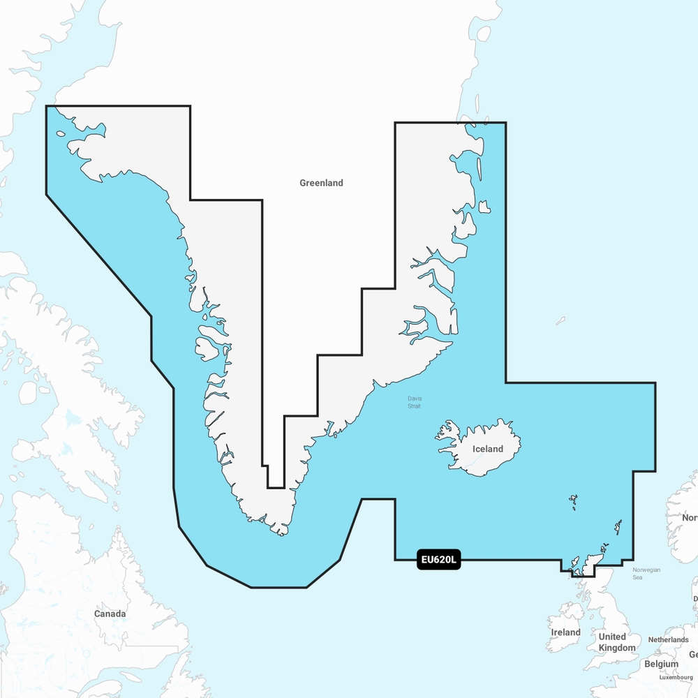
EU620L Greenland & Iceland
0
0
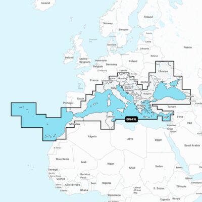
99238223
EU643L / 43XG Mediterranean
1
1
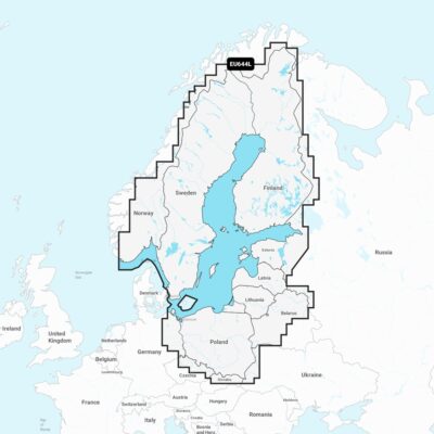
99664022
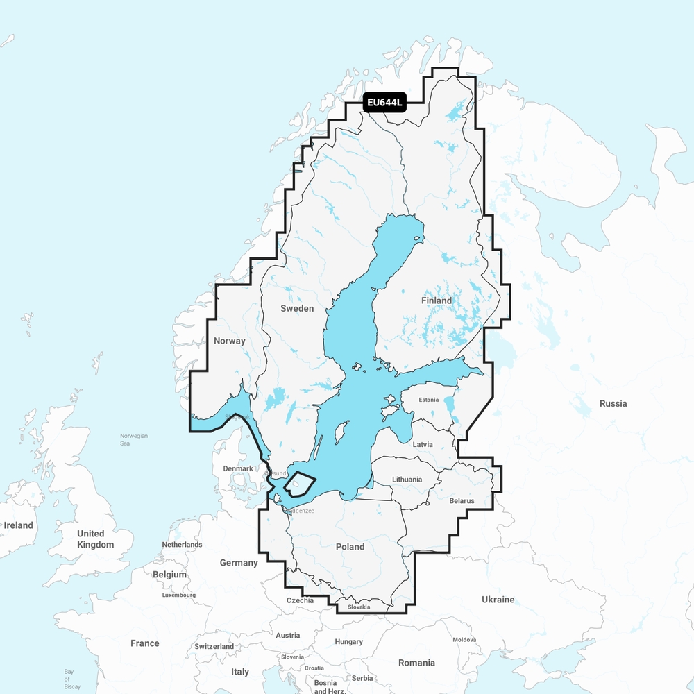
EU644L Baltic Sea
0
0
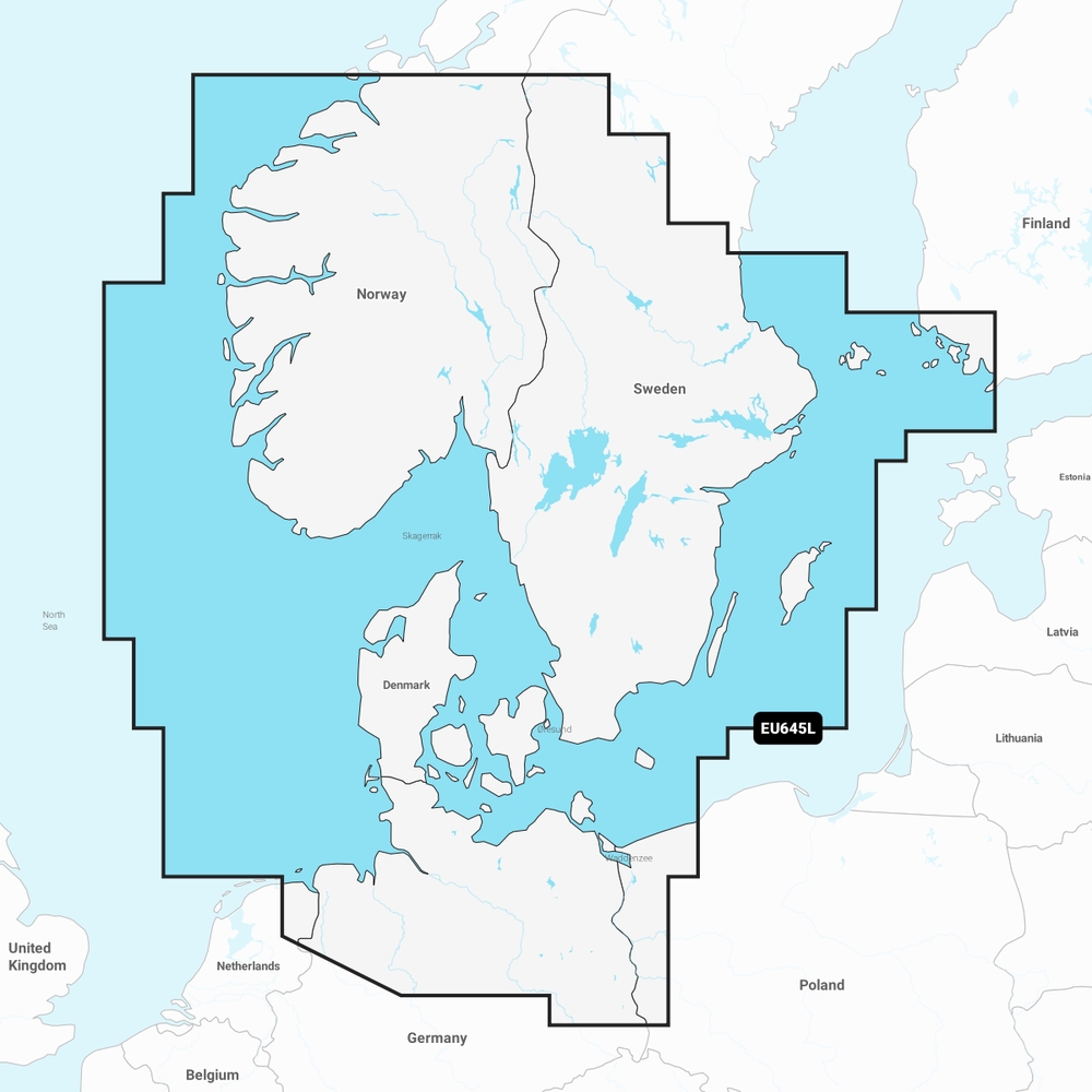
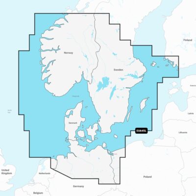
99664039
EU645L Skagerrak & Kattegat
0
1
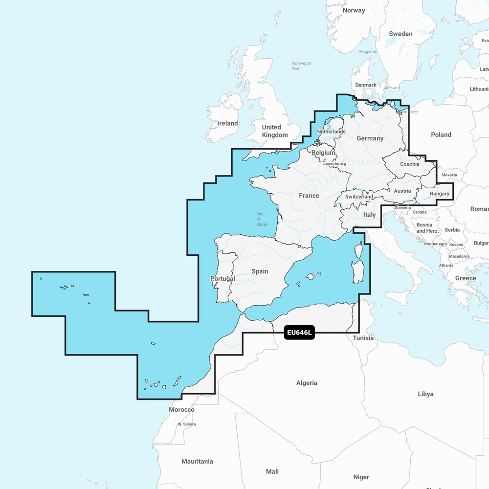
99238247
EU646L / 46XG Europe West
2
2
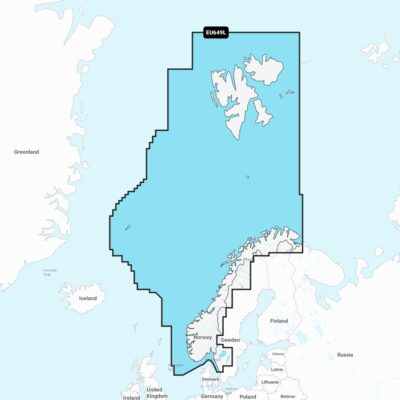
99664046
EU649L Norway
0
0
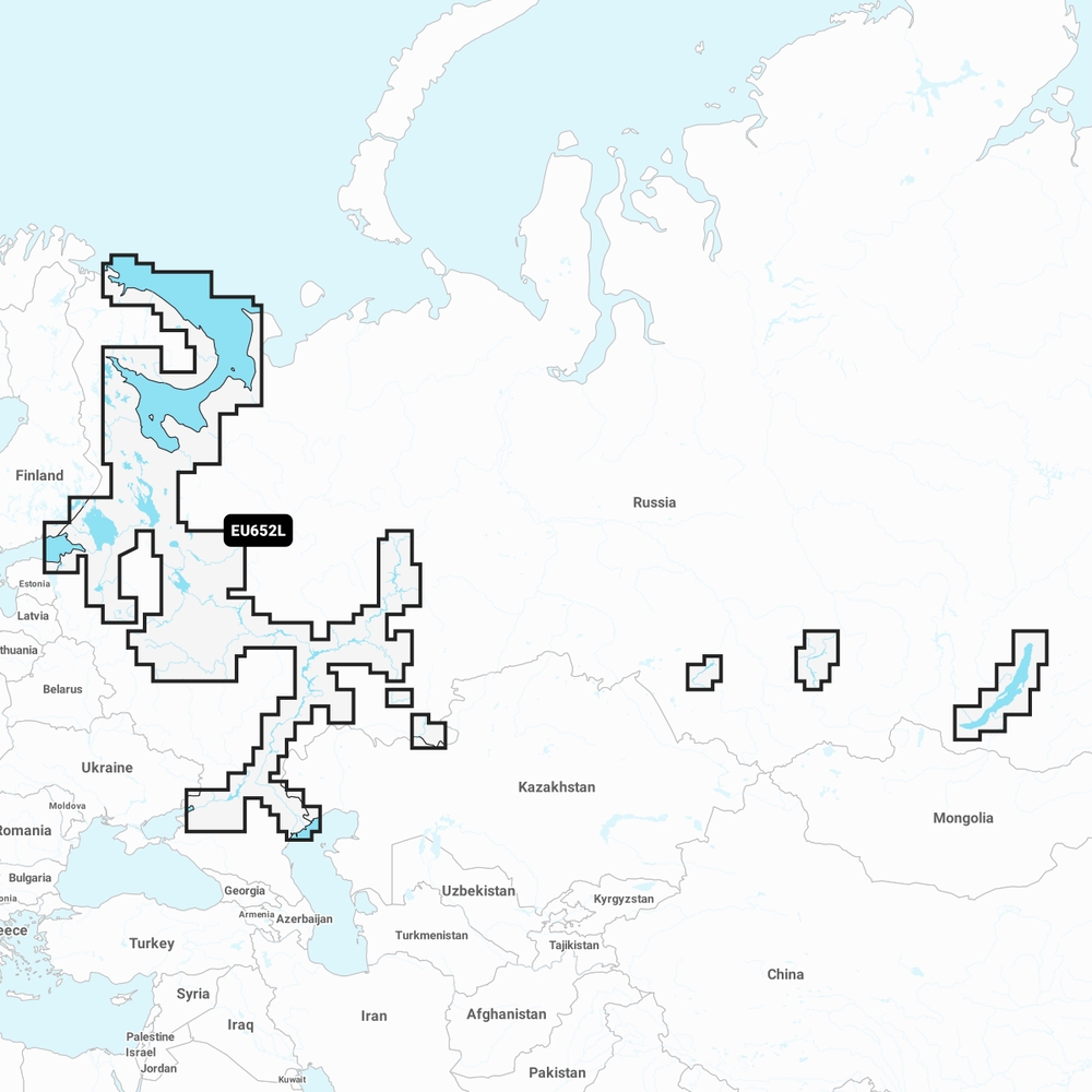
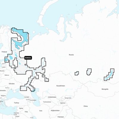
99664053
EU652L Russia, West
0
0