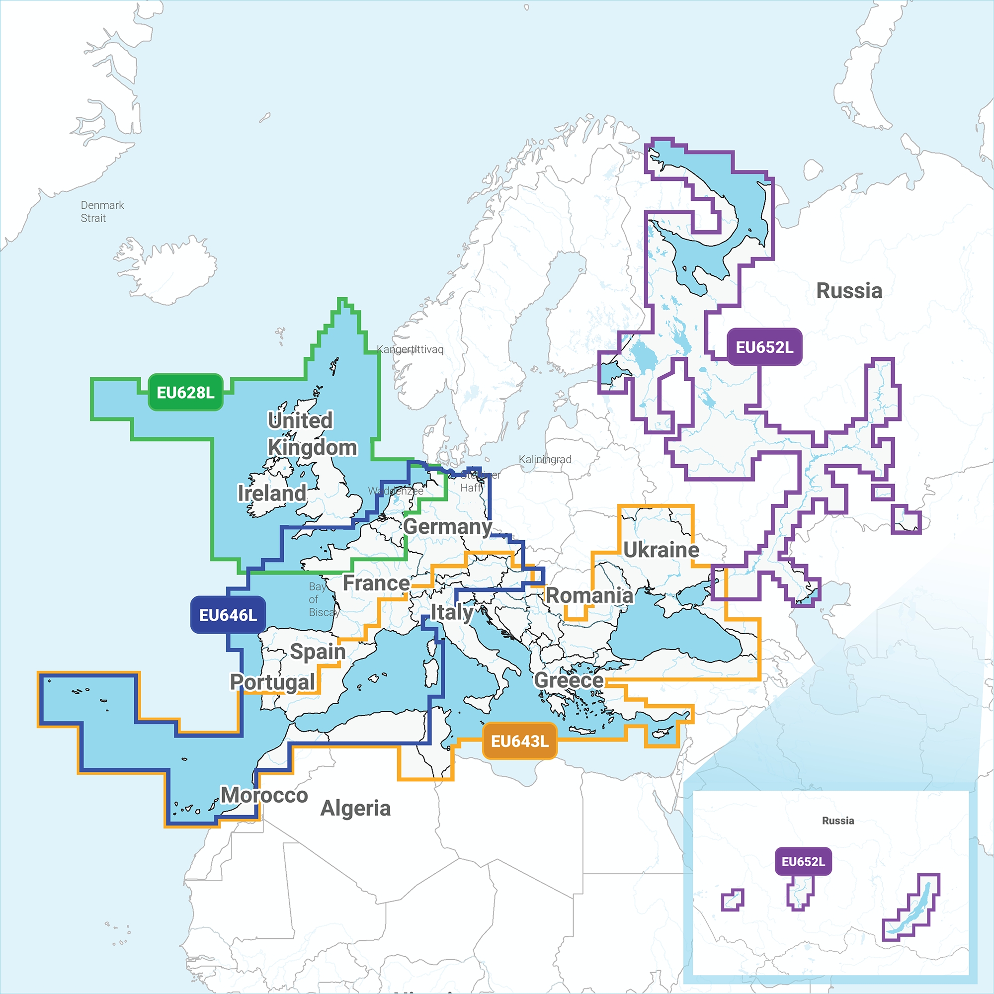


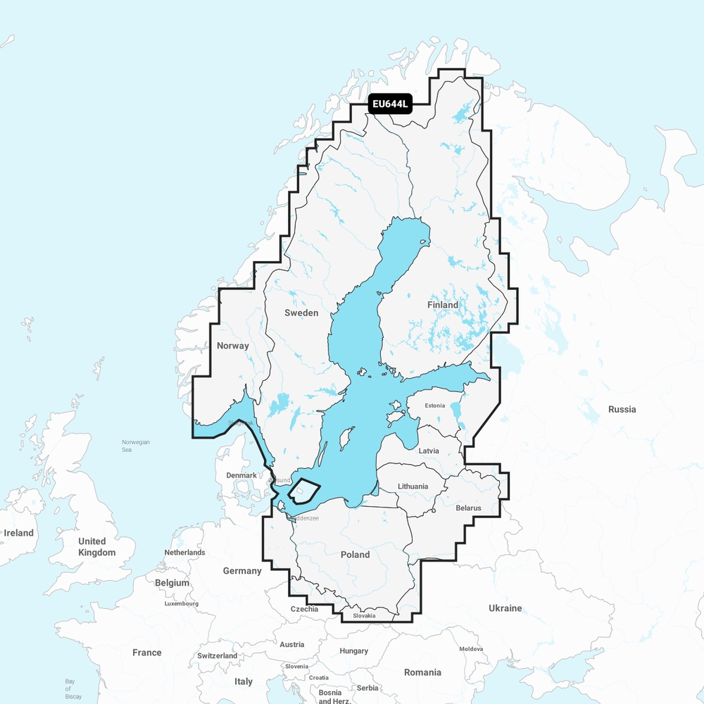
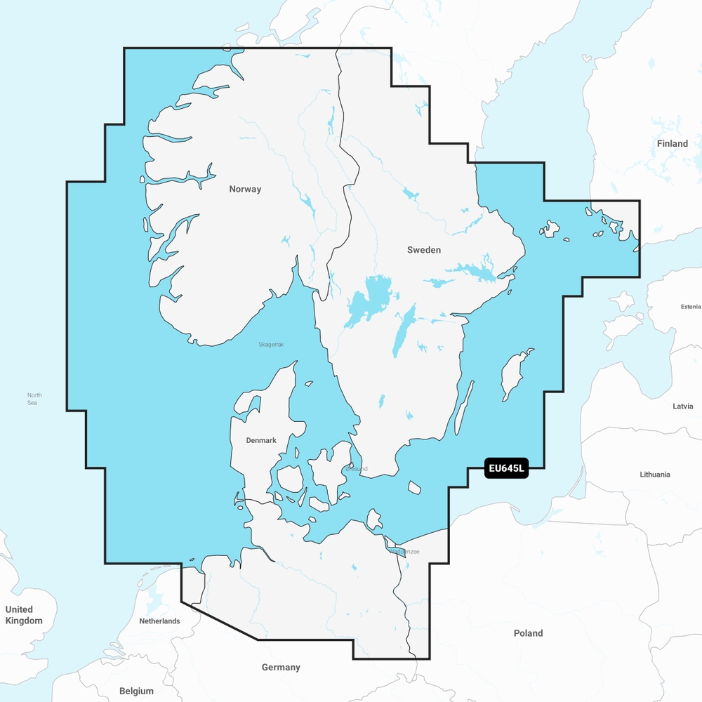


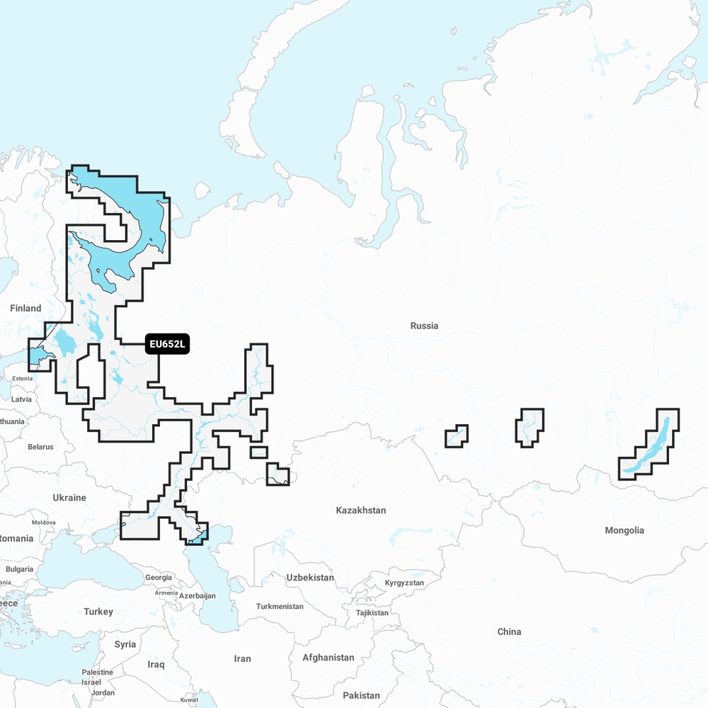

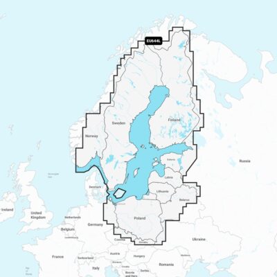
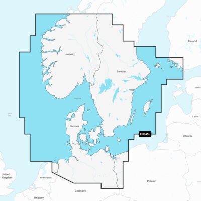
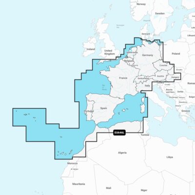
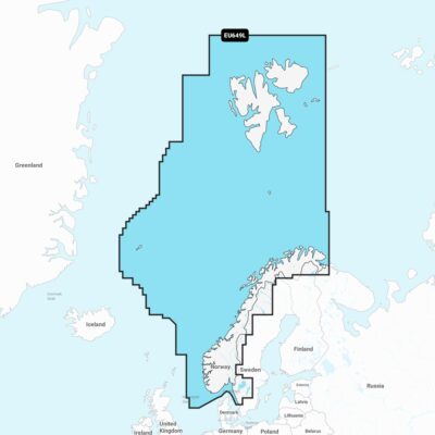

Navionics Platinum+ Large Charts
£319.99 £299.95
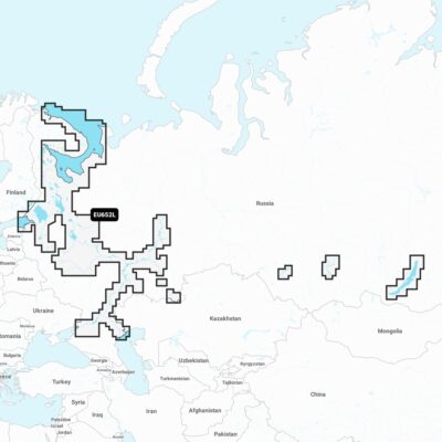
Navionics Platinum+™ charts include all the content of Navionics®+ cartography, with integrated offshore and inland mapping, 42,000+ lakes and additional viewing options for relief shading, satellite imagery with SonarChart shading overlay, 3D perspective view, aerial photos and more.
Please check the Navionics website for full compatibility. Navionics+ is not compatible with Garmin chartplotters. They use either Bluechart G3 or Garmin Navionics+.
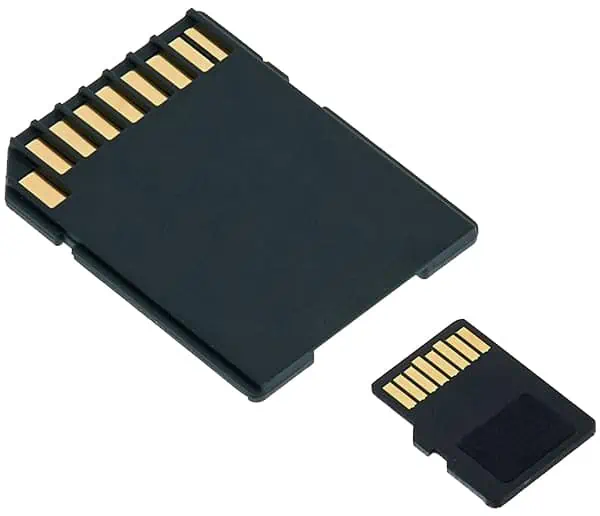
Please note: All charts come as a mirco SD inside an SD card adaptor.


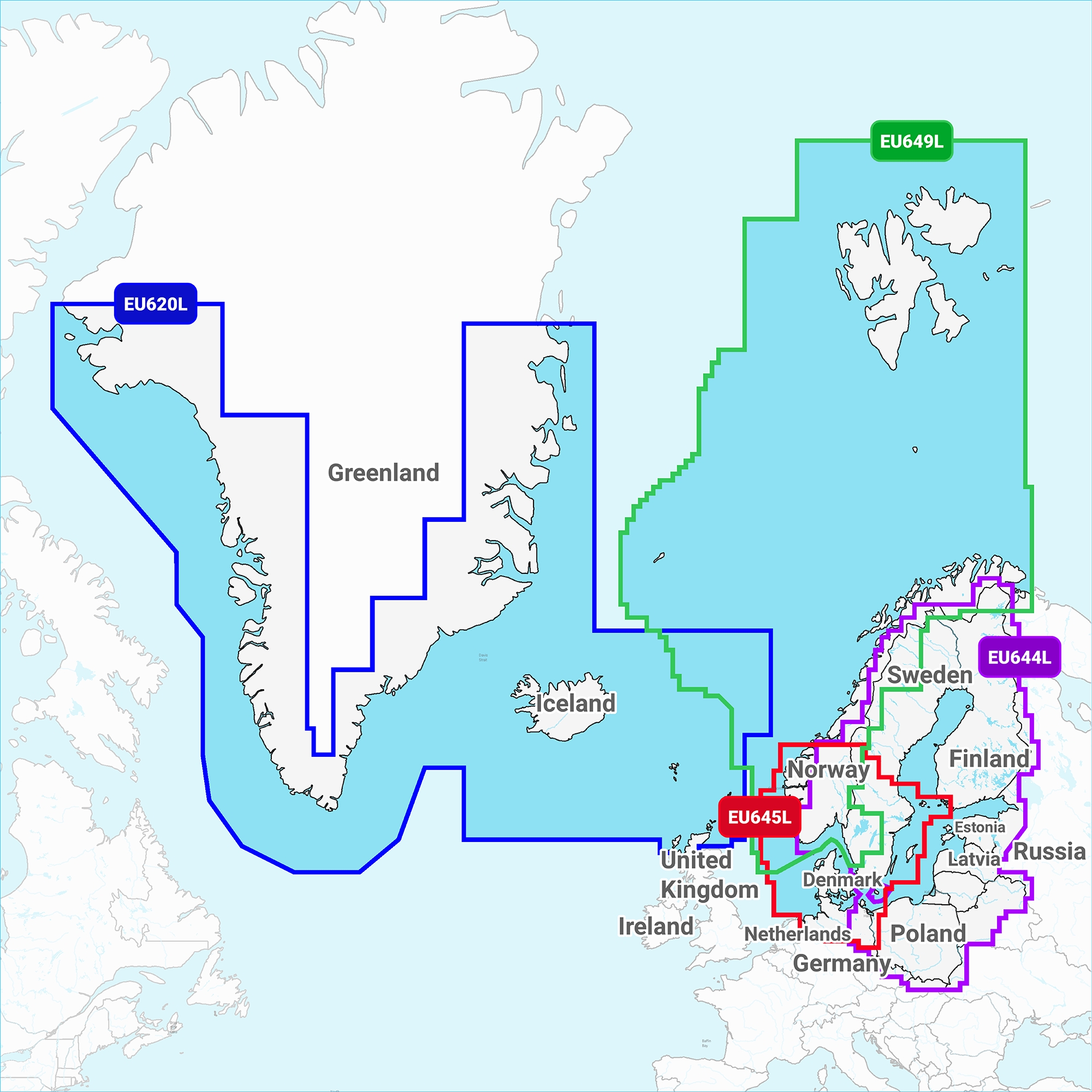
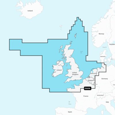
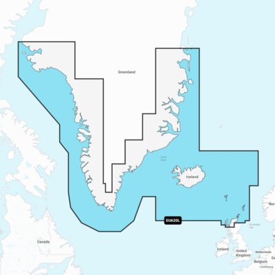
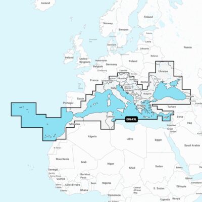
Navigate with the best offshore and inland lake coverage for your compatible chart plotter

See it your way. Customise your view with various chart layers & overlay combinations

Access daily updates via the Navionics® chart installer software.

Advanced route guidance technology lets you navigate with suggested dock-to-dock routings

Selectable map options let you highlight shallow areas, adjust contour density or select a fishing range

Save money – while continuing to access daily updates plus new content downloads – by renewing your subscription

all-in-one map solution
Access detail rich mapping of coastal features, lakes, rivers & more on a wide range of compatible chartplotters. Integrated coastal and inland lake content offers coverage for boaters worldwide.

DAILY CHART UPDATES
Charts are constantly being enhanced with new and amended content — thousands of updates are made every day. The included 1-year subscription gives you access to daily chart updates via the Navionics chart installer software.

DOCK-TO-DOCK ROUTE GUIDANCE
Advanced route guidance technology uses your boat settings, along with chart data and frequently travelled routes, to calculate a suggested path to follow from dock to dock.

UP TO 0.5M CONTOURS
For improved fishing and navigation, up to 0.5 m contours provide a clear depiction of bottom structure for fishing charts as well as enhanced detail in swamps, canals, harbours, marinas and more.

ADVANCED MAP OPTIONS
Change the way you view Navionics charts to focus on the details that matter most to you. Highlight shallow areas, adjust contour density, or select a fishing range.

COMMUNITY EDITS
Download community edits for useful local knowledge added by users of the Navionics Boating app, and view the data on your compatible chartplotter.

PLOTTER SYNC
Transfer routes and markers, update charts and more between your plotter card and mobile app — wirelessly. You can even activate or renew your cartography subscription and upload sonar logs

SONARCHART LIVE MAPPING
Create your own maps on the fly. Watch new 1’ HD bathymetry maps develop in real time as your boat moves through the water.


RELIEF SHADING
This downloadable shading feature combines colour and shadow to give you an easy-to-interpret, clearer view of bottom structure than contour lines alone.

HIGH RES SATELLITE IMAGERY
Downloadable high-resolution satellite imagery provides a realistic view of your surroundings — ideal for entering unfamiliar harbours or ports.

AERIAL PHOTOGRAPHY
Crystal-clear aerial and surface photos of ports, marinas, bridges, docks, boat ramps, dams and navigational landmarks provide a better sense of your surroundings above the waterline.

3D VIEW
Unique 3D views provide additional perspective, both above and below the water’s surface, to highlight key features and aid in situational awareness.