


Garmin g3 Vision Charts – Large
£ 389.99 £ 359.95
Please Note: Garmin Charts are programmed to order. Due to the size of the file, this process can take a few hours. For new Garmin Navionics charts Please Click Here
Garmin BlueChart g3 Vision Large Size. BlueChart g3 Vision is Garmin’s premium chart offering, bringing all the reliability and features of BlueChart g3 while adding in industry leading features, like AutoGuidance.
VEU721L – Northern Europe
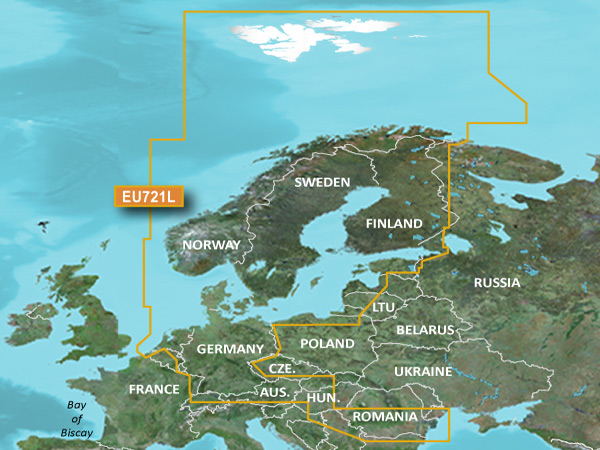
Detailed coverage of Scandinavian and North-Central European coast from Belgium to the Norway/Russia border including the inland waterways of the Netherlands, Germany and the Czech Republic and major lakes of Finland, Sweden and Central Europe and selected lake coverage in Denmark. Coverage includes but is not limited to Svalbard, the Baltic Sea, the Skagerrak and Kattegat Straits, the Gulfs of Bothnia, Finland, and Riga, the IJsselmeer, the Kiel/Lübeck/Flensburg Canal, the Rhine River, the Danube, Lake Constance, Lake Balaton, the Mazurian Lake District and Lake Peipus.
VEU722L – Europe Atlantic Coast
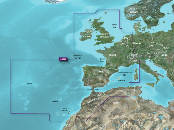
Detailed coverage of the Atlantic and Mediterranean coast of Western Europe, the British Isles and northwestern Africa. Coverage includes the Azores, Canary, Balearic, Channel, and Shetland Islands; Sardinia, Corsica and Madeira, the western Mediterranean Sea from La Spezia, IT to the Strait of Gibraltar, Bay of Biscay, English Channel, Irish Sea, Waddenzee, IJsselmeer, the inland canals and waterways of France and Benelux; the Garonne, Loire, Seine and Rhone River systems; the Rhine River to Neuwied, DE; Lake Leman (Geneva), the entire British Isles including Lough Neagh, the Caledonian Canal, the Isles of Wight and Man and the Thames River and Estuary; the coast of Africa from Cape Bojador, EH to Cape Bougaroun, DZ..
VEU723L – Southern Europe
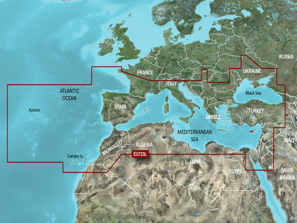
Detailed offshore coastal coverage of the Mediterranean Sea and the Iberian Peninsula in their entireties. Coverage features the Strait of Gibraltar, the Balearic Islands, the French Riviera, Corsica, Sardinia, Sicily, the Adriatic Sea, the Greek Islands, the Aegean Sea, the Dardanelles and Bosporus Straits, the Sea of Marmara, Cyprus, the Suez Canal, Tripoli and Algiers Harbors, and the Gulfs of Gabès and Tunisia. Also details the Atlantic side of the Iberian Peninsula from the Canary Islands to the Bay of Biscay including the Gulf of Cadiz, the Portugal coast in full, the Gulf of Gascogne, and the Madeira and Azores Islands.
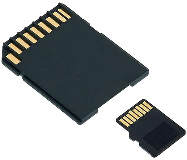
Please note: All charts come as a mirco SD inside an SD card adaptor.